I'm a developer, you know how we are....")
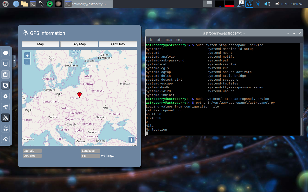
Debugging done, it seems it's loading the values from astropanel.config but doing nothing. Next step I'll try to rename astropanel.conf to force loading data from weather app.
Screenshot:
Ah, so perhaps it was my mistake assuming that the GPS panel would also show custom coordinates if GPS was not present, getting data from astropanel.config.
If that's the case, all is working as intended then. However it could be a nice add on feature for the future.")
Thanks for clarifying
It’s actually all excellent, the only advice I could offer, is to ditch the astropanel.conf file, as it’s not really needed, as the info can come from the weather app or a GPS, That is more than sufficent, as dummies like me don’t want to be going into config files and editing...as that’s how things break...
Or if the astropanel.conf file is needed, (for other reasons) then maybe make it easier for users to input there own data...
 Any ideas anyone, GPS now connected and I get this on both GPS and astropanel....
×
INDI Library v2.0.7 is Released (01 Apr 2024)
Bi-monthly release with minor bug fixes and improvements
Astroberry Server 2.0.0 is available now!
- Riccardo Sallusti
-
- Offline
- New Member
-


- Posts: 15
- Thank you received: 6
Replied by Riccardo Sallusti on topic Astroberry Server 2.0.0 is available now!
I'm a developer, you know how we are....
Debugging done, it seems it's loading the values from astropanel.config but doing nothing. Next step I'll try to rename astropanel.conf to force loading data from weather app.
Screenshot:
4 years 5 months ago
#46234
The topic has been locked.
- Radek Kaczorek
-
 Topic Author
- Offline
- Moderator
-

- Posts: 983
- Thank you received: 375
Replied by Radek Kaczorek on topic Astroberry Server 2.0.0 is available now!
To clarify GPS Panel and Astro Panel functionalities and how they work.
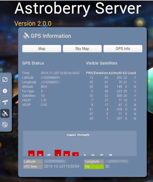
GPS Panel - shows GPS position and time read from real GPS. Additionally it shows satellites and signal strength.
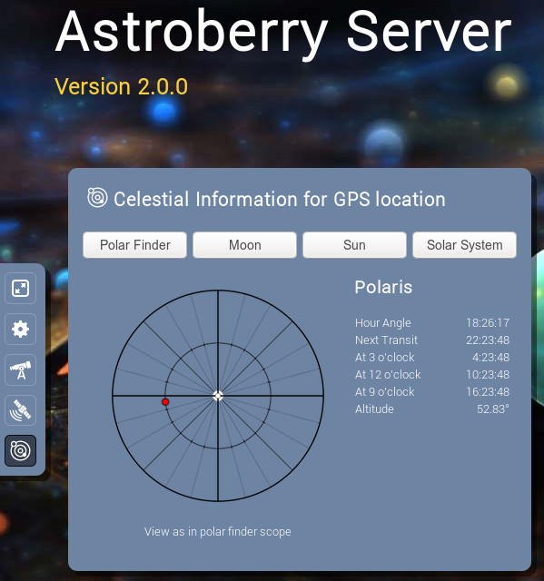
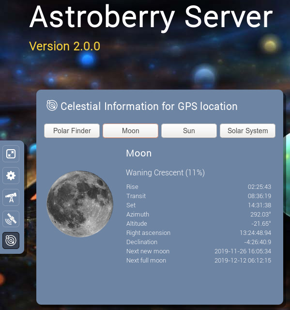
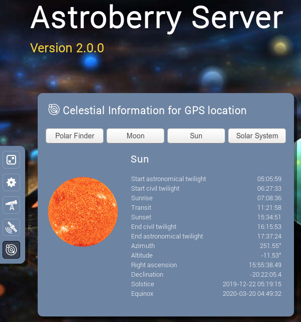
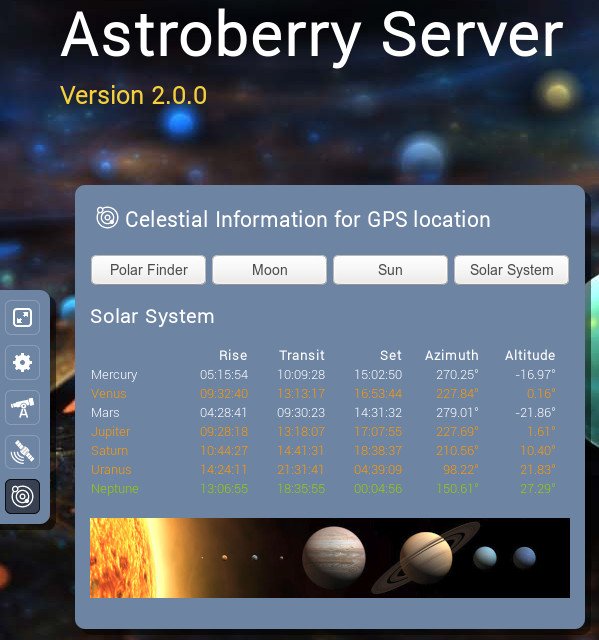
Astro Panel - shows information about Polaris, Moon, Sun and Solar System planets. It get's location from GPS or /etc/astropanel.conf file. If no GPS and config file exist it gets location from Weather Plugin. If none of these exist it will show demo data, which are set to Warsaw, Poland.
See the screenshots below.
GPS Panel
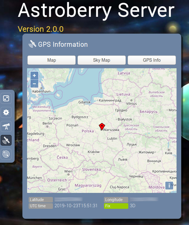
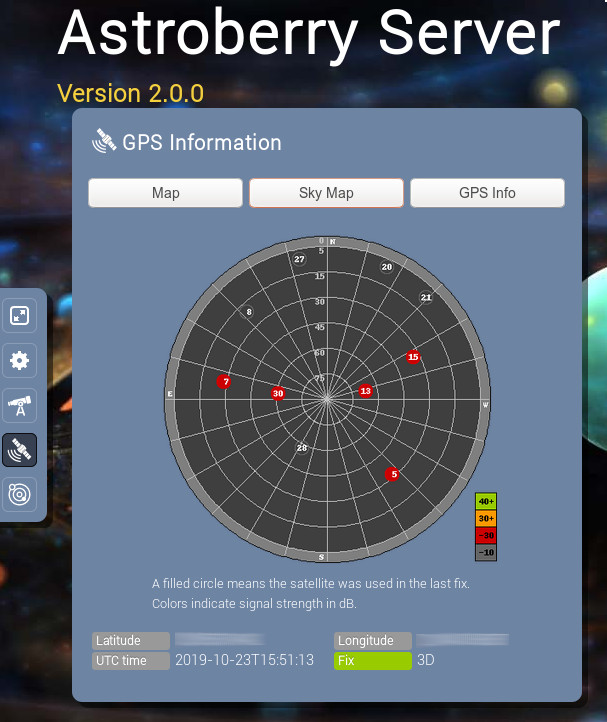
Astro Panel
GPS Panel - shows GPS position and time read from real GPS. Additionally it shows satellites and signal strength.
Astro Panel - shows information about Polaris, Moon, Sun and Solar System planets. It get's location from GPS or /etc/astropanel.conf file. If no GPS and config file exist it gets location from Weather Plugin. If none of these exist it will show demo data, which are set to Warsaw, Poland.
See the screenshots below.
GPS Panel
Astro Panel
The topic has been locked.
- Riccardo Sallusti
-
- Offline
- New Member
-
- Posts: 15
- Thank you received: 6
Replied by Riccardo Sallusti on topic Astroberry Server 2.0.0 is available now!
Ah, so perhaps it was my mistake assuming that the GPS panel would also show custom coordinates if GPS was not present, getting data from astropanel.config.
If that's the case, all is working as intended then. However it could be a nice add on feature for the future.
Thanks for clarifying
The following user(s) said Thank You: Radek Kaczorek, AstroNerd
4 years 5 months ago
#46236
The topic has been locked.
Replied by AstroNerd on topic Astroberry Server 2.0.0 is available now!
So looking at the posts above, are we to assume that making changes in the astropanel.conf file will just update the info in the astropanel, and do nothing for the GPS panel, that will still default to Warsaw, unless we have a GPS Adapter connected and working, then it will update to our own current position....
Have I got that correct..?.
And editing that file, is that the only or proper way to update that info, or is there another as I don’t want to mess any files up...
Have I got that correct..?.
And editing that file, is that the only or proper way to update that info, or is there another as I don’t want to mess any files up...
The topic has been locked.
- Radek Kaczorek
-
Topic Author
- Offline
- Moderator
-
- Posts: 983
- Thank you received: 375
Replied by Radek Kaczorek on topic Astroberry Server 2.0.0 is available now!
This is absolutely correct. GPS Panel is designed to show real and the actual GPS position and if it is not available it shows default position (hard coded because it needs to show something). Should you consider any other approach do not hesitate to suggest it. It was just my assumption but I would be more than happy to do it the way you want.
To change this behavior you need to change gpspanel.py file, which I do not recommend because all the changes will be overwritten by future updates. So it is better I change it for all the users.
Changing astropanel.conf does nothing to gpspanel. It just works with Astro Panel, which calculates bodies positions for a specific location (which can come from GPS or static config).
BTW. I agree it is kind of a mess but I haven't came up with a good solution. As for now there are separate locations for:
1. Astro Panel (GPS or astropanel.conf file or Weather Plugin location)
2. GPS Panel (only real GPS receiver)
3. KStars (GPS or static configuration of KStars location)
Any ideas how to combine these? Bear in mind that before first start of Kstars it's configuration defaults to London, before connecting GPS receiver GPS Panel defaults to Warsaw, before setting up astropanel.conf Astro Panel defaults to GPS or Weather Plugin
4 years 5 months ago
#46247
The topic has been locked.
- Riccardo Sallusti
-
- Offline
- New Member
-
- Posts: 15
- Thank you received: 6
Replied by Riccardo Sallusti on topic Astroberry Server 2.0.0 is available now!
My suggestion:
GPS Panel uses GPS only if a GPS is present, otherwise it defaults to a config file that, at this point, could be unique for both GPS and Astro panels.
If no config file, then the weather app, as you already do, could be second choice.
This way you simplify it a bit.
In StellarMate, all system's coordinates are got from the mobile app: sometimes, even if I use StellarMate at home, I first connect to it with the mobile app, just to set or update the gps position.
Is AstroBerry we do non have a mobile app (yet...) so a unique config file could be the solution.
Cheers.
The following user(s) said Thank You: AstroNerd
4 years 5 months ago
#46248
The topic has been locked.
Replied by AstroNerd on topic Astroberry Server 2.0.0 is available now!
It’s actually all excellent, the only advice I could offer, is to ditch the astropanel.conf file, as it’s not really needed, as the info can come from the weather app or a GPS, That is more than sufficent, as dummies like me don’t want to be going into config files and editing...as that’s how things break...
Or if the astropanel.conf file is needed, (for other reasons) then maybe make it easier for users to input there own data...
The following user(s) said Thank You: Craig
The topic has been locked.
Replied by AstroNerd on topic Astroberry Server 2.0.0 is available now!
The topic has been locked.
Replied by AstroNerd on topic Astroberry Server 2.0.0 is available now!
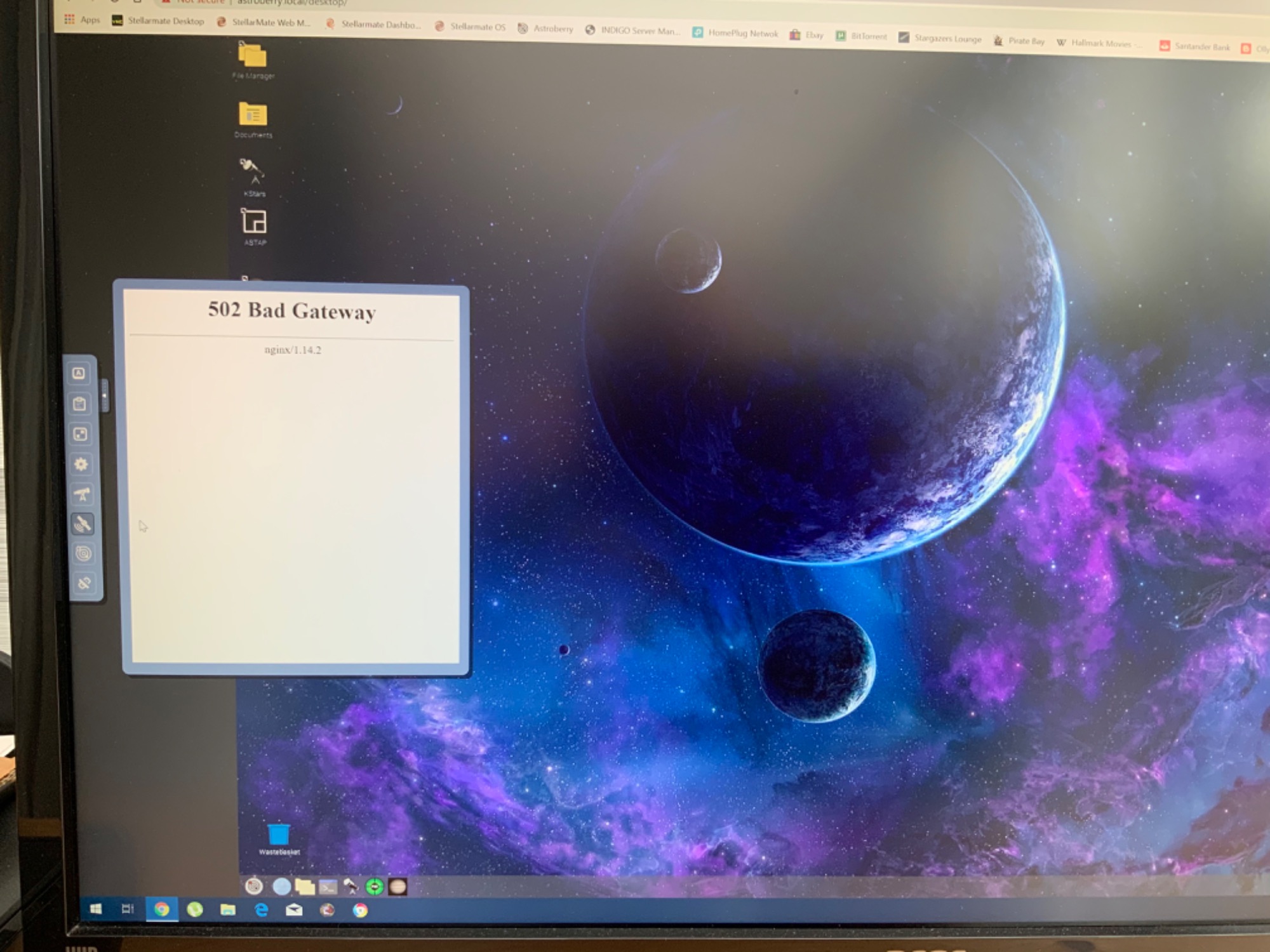
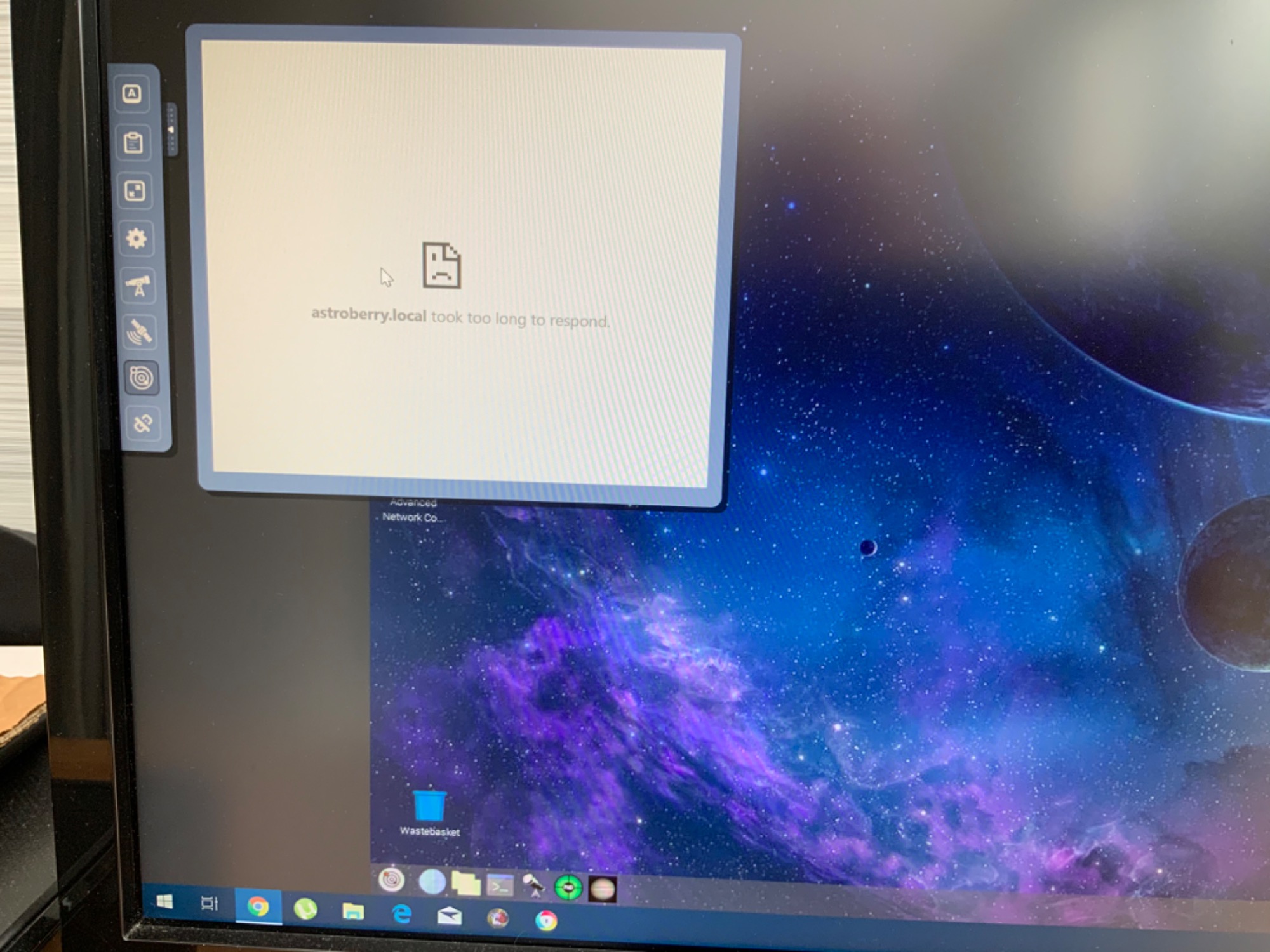
Now showing this....not sure what has happened...
4 years 5 months ago
#46262
The topic has been locked.
Replied by AstroNerd on topic Astroberry Server 2.0.0 is available now!
Ok, false alarm, a second reboot seemed to sort it. ")
4 years 5 months ago
#46263
The topic has been locked.
Replied by AstroNerd on topic Astroberry Server 2.0.0 is available now!
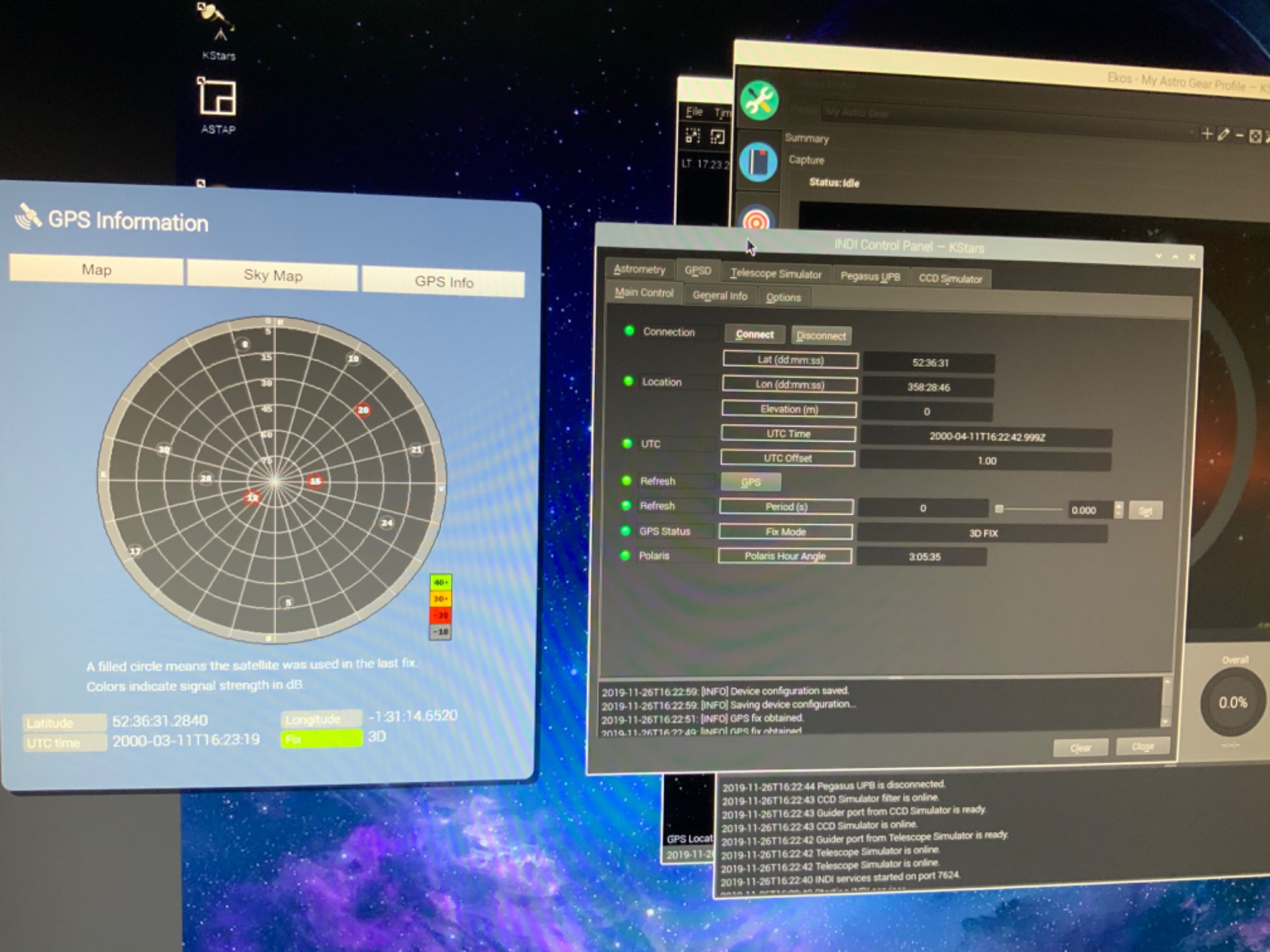
Ok, so I got a GPS fix in Ekos, and on the panel....
The topic has been locked.
- Clive Stachon
-

- Offline
- Elite Member
-

- Posts: 407
- Thank you received: 74
Replied by Clive Stachon on topic Astroberry Server 2.0.0 is available now!
Radek here is my suggestion:-
1. Simplify - do we need the skymap,full GPS info - i dont but interested to know if others do. The location map is fine and enough for me !
2. Set up simple ALL user environment variables called Latposition,Lonposition,Elevation (names could be anything ). Allow user to set these via a simple Web interface/panel. Put them in users profile. That makes them permanent (unless edited again). Should only need to be done once unless user has moved location and has no GPS and no internet. This becomes the default!
3. Location map function - using something like openstreetmap we can simply allow a user to select a location and get the coordinates (lat/Long) example here forum.openstreetmap.org/viewtopic.php?id=57038
and set Environment vars above to extracted Lat/Lon. Again only needs to be done once per session BUT does need Internet
4. Using GPSPIPE command and DQ application (json parser) extract Lat,Lon,Elevation,Date/Time - null is returned if nothing exists for TPV data - so command could be as simple as gpspipe -w -n 4 -p |grep TPV |jq .lon (for longtitude) and set Environment variable appropriately. but only if value is returned (the GPSPIPE command will return nothing if no TPV data has been produced.
This could be a script on a timer as per GPSPanel. GPSPIPE doesn't need root permissions to work with GPSD !
This will have no effect if no GPS device is fitted or working!
Note - have tried out the simple GPSPIPE commands on my Ublox7 and they work - when the GPS device works.
So unless the Environment vars have been changed in one of the above ways the "default" ones in the profile will always apply.
This is much like you existing system but simpler IMO and doesn't depend on Python but would need Java for the Openstreetmap item described in (3).
Anyway just an idea !
RPI3 Ubuntu 16.04 / AMD desktop Kstars under Ubuntu 16.04 Mounts :azeq6 ,SWAZGoTo
RPI3 Fedora testing out on AMD desktop Fedpra 28 - running kstars 2.9.4 , Indilib 1.7.4 ?????
RPI3 Fedora testing out on AMD desktop Fedpra 28 - running kstars 2.9.4 , Indilib 1.7.4 ?????
4 years 4 months ago
#46277
The topic has been locked.
Moderators: Radek Kaczorek
Time to create page: 0.879 seconds
© 2003-2022 by INDI Library. All rights reserved.